|
前言本系列文章介绍一个简单的实时定位示例,示例的组成主要包括: - 服务后端,使用 Java 语言编写,模拟生成 GeoJSON 数据。
- 前端展示,使用 Vue + OpenLayers ,负责定时向后端服务请求 GeoJSON 数据,并在以标签的形式展现定位数据。
实现的效果: 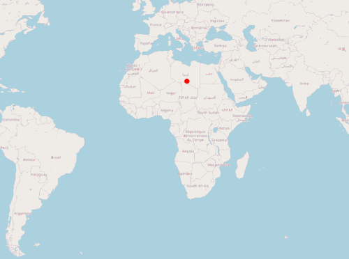
一、定义标签样式 var image = new CircleStyle({ radius: 5, fill: new Fill({ color: "rgba(255, 0, 0, 1)" }), stroke: new Stroke({ color: "red", width: 1 }) }); var styles = { Point: new Style({ image: image }) }; var styleFunction = function(feature) { return styles[feature.getGeometry().getType()]; };
二、模拟 GeoJSON 数据 var geojsonObject = { type: "FeatureCollection", features: [ { type: "Feature", geometry: { type: "Point", coordinates: [0, 0] } } //此处可以添加更多 feature ] };
三、创建 VerctorLayer //读取 GeoJSON, 将其作为 vectorSource 的数据源 var vectorSource = new VectorSource({ features: new GeoJSON().readFeatures(geojsonObject) }); var vectorLayer = new VectorLayer({ source: vectorSource, style: styleFunction });
四、构建地图 mounted() { this.map = new Map({ layers: [ new TileLayer({ source: new OSM() }), vectorLayer ], target: "map", view: new View({ center: [0, 0], zoom: 2 }) }); //设置定时任务,调用移动标签方法 setInterval(this.translate, 500); },
五、模拟实时移动 methods: { translate() { //遍历标签, 修改坐标位置 vectorSource.forEachFeature(function(f) { console.log("translate"); //随机产生坐标增量(此处不是坐标绝对值!!!!) var x = Math.random() * 1000000; var y = Math.random() * 1000000; f.getGeometry().translate(x, y); }); } }
总结以上是一个简单实时定位前端示例,通过模拟的 GeoJSON 对象展示标签,并通过定时任务模拟标签位置变化。下一篇将使用 Java 服务端提供位置数据,完整模拟一个实时定位系统。
可以在vue项目中直接运行的完整代码: <template> <div> <span>hi, map</span> <div id="map" class="map"></div> </div> </template> <script lang="ts"> import "ol/ol.css"; import GeoJSON from "ol/format/GeoJSON"; import Map from "ol/Map"; import View from "ol/View"; import { Circle as CircleStyle, Fill, Stroke, Style } from "ol/style"; import { OSM, Vector as VectorSource } from "ol/source"; import { Tile as TileLayer, Vector as VectorLayer } from "ol/layer"; import Vue from "vue"; var image = new CircleStyle({ radius: 5, fill: new Fill({ color: "rgba(255, 0, 0, 1)" }), stroke: new Stroke({ color: "red", width: 1 }) }); var styles = { Point: new Style({ image: image }) }; var styleFunction = function(feature) { return styles[feature.getGeometry().getType()]; }; var geojsonObject = { type: "FeatureCollection", features: [ { type: "Feature", geometry: { type: "Point", coordinates: [0, 0] } } ] }; var vectorSource = new VectorSource({ features: new GeoJSON().readFeatures(geojsonObject) }); var vectorLayer = new VectorLayer({ source: vectorSource, style: styleFunction }); export default Vue.extend({ data() { return { map: {} }; }, mounted() { this.map = new Map({ layers: [ new TileLayer({ source: new OSM() }), vectorLayer ], target: "map", view: new View({ center: [0, 0], zoom: 2 }) }); setInterval(this.translate, 500); }, methods: { translate() { vectorSource.forEachFeature(function(f) { console.log("translate"); var x = Math.random() * 1000000; var y = Math.random() * 1000000; f.getGeometry().translate(x, y); }); } } }); </script> <style> .map { width: 100%; height: 600px; } </style>到此这篇关于VUE + OPENLAYERS实现实时定位功能的文章就介绍到这了,更多相关VUE OPENLAYERS 定位内容请搜索wanshiok.com以前的文章或继续浏览下面的相关文章希望大家以后多多支持wanshiok.com!
基于Vue+Openlayer实现动态加载geojson的方法
Vue+Openlayer批量设置闪烁点的实现代码(基于postrender机制) |
